- Download/View Walk Map
- 3 kms / About 1:15 hrs
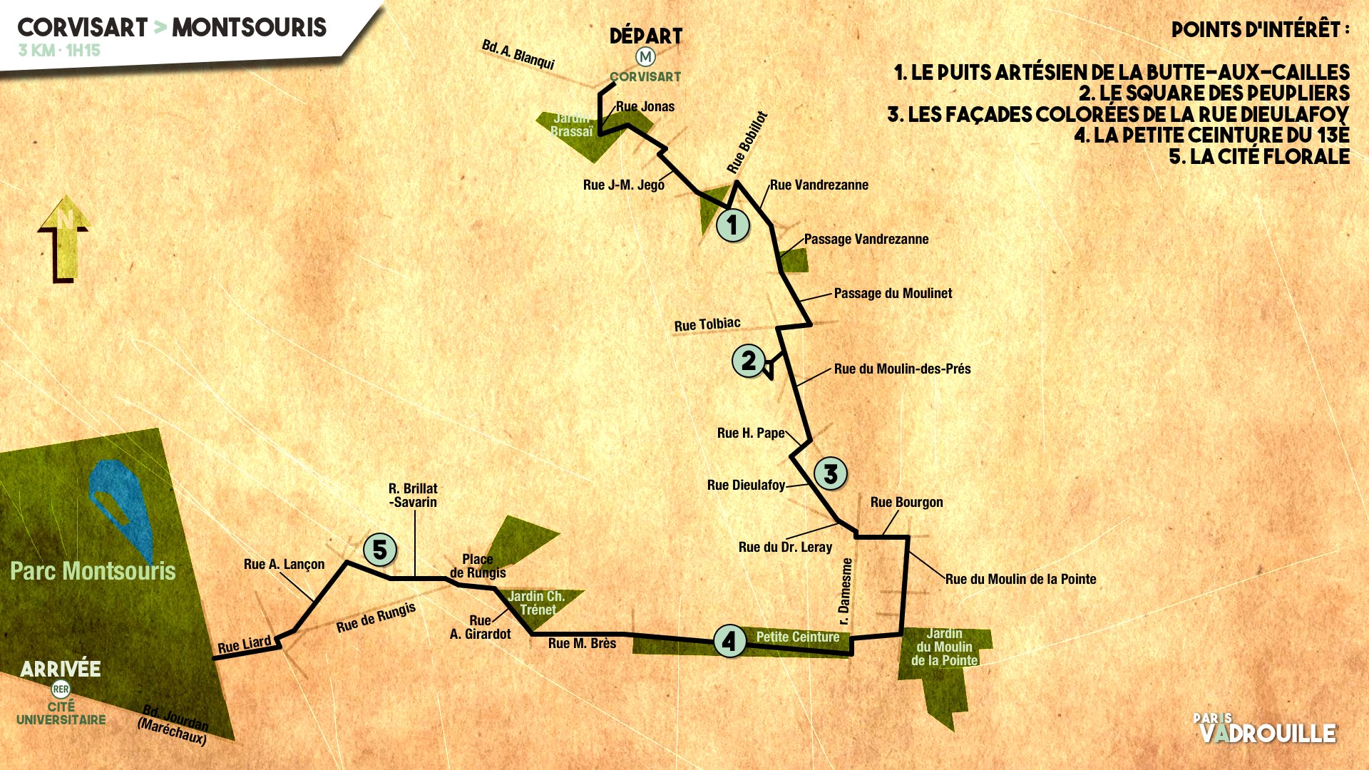
- Start : Metro line 6, Corvisart
- Finish : RER line B / Tram line 3a, Cité Universitaire
- Anytime of the year

The artesian well on Place Verlaine.
The artesian well on the Butte aux Cailles
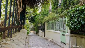
From the Corvisart metro station, walk under the building at 51 boulevard Blanqui to reach the steps leading to Jardin Brassaï. Follow the path on the left until you reach rue Jonas and then turn into Samson then Jean-Marie Jego streets to reach the heart of la Butte aux Cailles, crossed by rue Bobillot. Across this very street, on Place Verlaine, you will see the artesian well where the inhabitants of the neighbourhood (and others) come to get water, just like a few others in Paris. Read our story about the well here.
The Poplar Triangle
In the Square des Peupliers.
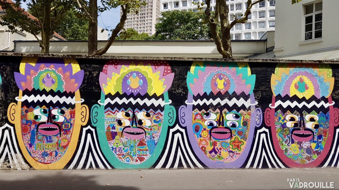
Head to Rue Vandrezanne. Street art lovers will be delighted with the vividly coloured murals on the school walls on the left. On the small plazza, head to the right and down the passage Vandrezanne. Cross rue du Moulinet and take the little quiet passage of the same name until rue Tolbiac. There, take a right and a left to walk down rue du Moulin-des-Prés. A little further down at n°72 you will find the Square des Peupliers (Poplars Place), a town-planning oddity in la Butte aux Cailles : a residential triangle-shaped neighbourhood made of small houses and low-rise buildings.
Colourful facades in rue Dieulafoy
Walk out of the square and walk further down rue du Moulin-des-Prés. Turn right into rue Henri Pape and left into rue Dieulafoy. There you will find in all their pastel glory houses from the 1920s built for middle-class families (a standard that has seemingly evolved) offering an appealing perspective to this little cobblestone rue. Follow rue du Dr Leray on the left and straight ahead rue Bourgon. Turn left on rue du Moulin de la Pointe and walk on.
La Petite Ceinture puts the neighbourhood back on track(s)
The old tracks of la Petite Ceinture.
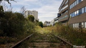
If you need a break, you can turn left into the Jardin du Moulin de la Pointe sitting at the foot of the impressive residential Tour Chambord. Then, take the narrow passage along the school at the end of Place des 44 Enfants d’Izieu, then turn left rue Damesme, where you will find an entrance to la Petite Ceinture (the little belt). Opened in 2016, this area is a symbol of Paris’s will to restore its old inner rail system and find new recreational uses for it. The neighbourhood around it has also undergone significant changes. When you exit the park, walk on ahead and up rue Madeleine Brès. Then make a left and down into rue Annie Girardot, overlooking the Jardin Charles Trénet flanked with brand new environment-friendly, low-energy buildings.
“Welcome to Wisteria Lane…”
An oleander in Rue des Glycines (Wisteria Street).
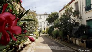
When you reach Place de Rungis, head to rue Brillat-Savarin. Soon on the right, you will see the first houses of the Cité Florale. This other triangular cluster of houses has cultivated its rural charm since its creation in 1928 and attracted walkers and dreamers alike (as well as their selfie sticks lately). Walk back to rue Brillat-Savarin and turn left a little further into rue Lançon and then, after the crossing with rue de Rungis, take rue Liard and enter the 14th arrondissement.
The lines of Montsouris

Guérite de garde dans le Parc Montsouris.
Below rue Liard, on the right, you can see the Petite Ceinture that you saw a few minutes before coming out of a tunnel and going into another right under Parc Montsouris for one kilometre, resurfacing rue du Père Corentin. Montsouris is the final objective of this walk. It was opened roughly at the same time as the other great Parisian parks in the 1850s-60s (Boulogne, Vincennes, Buttes-Chaumont), and offers the same features : English-style landscape gardens, artificial slopes built on former quarries, recreational buildings that have been long gone. However, it has one specificity as it is crossed by the Paris meridian, an invisible line materialised by the Mire du Sud, a stone monument used as a geographical marker at the south of the park. The Paris meridian used to define universal time until 1883, when the Greenwich meridian in London was chosen as the new defining line.

